

A while ago the internet was abuzz with talk of a tool called NukeMap, a Google Maps mashup that let users virtually blow up cities with nuclear bombs. The site was more educational than malicious, letting people witness the devastating effects of atomic weapons without, y’know, any of the adverse effects.
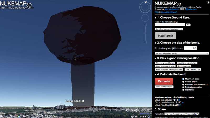
Now, the author of NukeMap has made a 3D version of his popular web app, to give us a whole new perspective on the whole nuclear detonation damage assessment. Whereas NukeMap 2D only had concentric circles to plot fireballs, blast radii, and fallout, NukeMap 3D goes a step further. It’s now possible to navigate a 3D landscape – surprisingly, there are bits of the major South African cities with 3D building data – and witness the mushroom cloud of doom from a variety of viewpoints. Perhaps you want to see it from the air. Or from just outside your house. Or right at ground zero.
Either way, you’ll leave with a healthy respect for nuclear bombs.

